Introduction to Geospatial Technologies for Achieving SDGs – Building Resilience
Course dates: July 24-28, 2023
Venue: Central European University, Budapest, Hungary
Workshop information
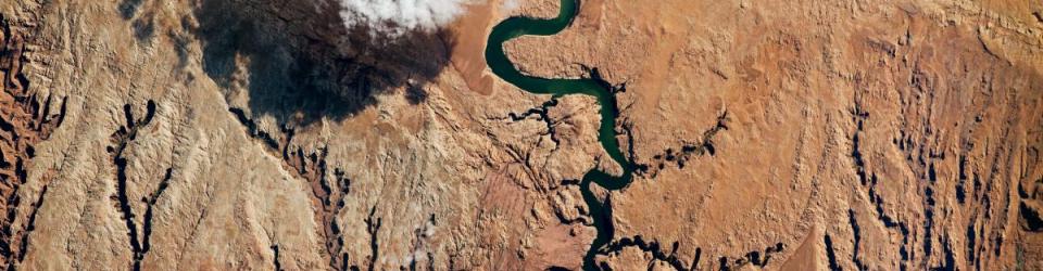
Geospatial technologies and remote sensing are valuable resources to monitor the United Nation's Sustainable Development Goals (SDGs) and their corresponding targets and indicators. They allow for unbiased observation and analysis across borders, administrative boundaries, and nations. Furthermore, geospatial information and technologies are particularly critical to strengthening urban and rural resilience, where economic, agricultural, and various social sectors intersect. This is particularly reflected through the mission of SDG-11 – to "Make cities and human settlements inclusive, safe, resilient, and sustainable".
However, there is still a gap between the tremendous potential of these technologies and the world of environmental decision- and policy-makers. Not only can the immense realm of geospatial technologies seem daunting, it is also difficult to keep up with the ever-evolving applications of geospatial technologies.
This workshop aims to address this gap by providing in-service education and professional training for decision-makers and practitioners to assist them in making better informed data-driven decisions. Furthermore, the workshop looks towards the future, engaging youth and our future leaders in the current practices of evidence-based decision-making.
The target group for this workshop includes professionals from national agencies and international organizations, relevant NGO representatives, and academia, both students and faculty. Within academia, priority will be given to graduate students in public policy and environmental management from the OSUN and CIVICA partner institutions.
This year’s workshop explores the use of geospatial technologies for building and improving the resilience of communities to disasters and climate change. Keynote speakers will give theoretical presentations and share their best-use practices of geospatial technologies, which will be followed by practical sessions on their application.
The workshop is organized by Central European University (CEU) and the American University of Central Asia (AUCA) in cooperation with the United Nations Office for Outer Space Affairs (UNOOSA). The workshop is co-funded by the Open Society University Network (OSUN), and OSUN students and faculty are especially encouraged to apply and gain financial support as well as ECTS credits.
Target group
- Environmental and public policy professionals in relevant domains;
- Students, faculty and researchers from the OSUN and CIVICA networks.
Pre-requisites
- Proven professional and/or academic focus on resilience-related topics (disaster risk reduction, climate change adaptation, environmental studies, etc.) or geospatial technologies (GIS, remote sensing);
- Intermediate computer user skills.
Language requirements
The language of instruction is English; thus all applicants have to demonstrate a strong command of spoken and written English to be able to participate actively in discussions at seminars and workshops.
Workshop Directors
Viktor Lagutov, ISEPEI Project, Central European University (CEU)
Lorant Czaran, United Nations Office for Outer Space Affairs (UNOOSA)
Kanat Sultanaliev, Tian Shan Policy Center, American University of Central Asia (AUCA)
Workshop Faculty
Alan Belward, European Commision's Joint Research Center (JRC)
Anupam Anand, Global Environment Facility (GEF), World Bank Group
Carolina Starr, UN Food and Agriculture Organization (FAO)
Ed Parsons, Google
Guenter Doerffel, Esri Global
Mariangela Cataldo, European Space Agency (ESA)
Masahiko Nagai, Yamaguchi University
Nelson Ribeiro, UN Food and Agriculture Organization (FAO)
Olaf Neussner, UN Office for Disaster Risk Reduction (UNDRR)
Where to apply?
For information on the workshop and application procedures, please visit: https://summeruniversity.ceu.edu/courses/geospatial-technologies-building-resilience
Should you have questions or concerns, do not hesitate to contact us at: isepei@ceu.edu or info@isepei.org
About ISEPEI
The Introduction to Geospatial Technologies for Achieving SDGs – Building Resilience workshop continues the series of joint UN-CEU training events under the ISEPEI Project “Bridging ICTs and the Environment”. The ISEPEI Project aims to address the gap between the geospatial industry and practitioners by providing in-service education and professional training for environmental decision-makers and practitioners, who can benefit greatly from this data revolution to better shape management strategies and make more informed, data-driven decisions.
The “Bridging ICTs and the Environment” workshop series provides an opportunity for non-specialists to get updated on the latest advances in geospatial technologies and to see how these technologies can be applied in monitoring various Sustainable Development Goals (SDGs). Sattelite Imagery, Geographic Information Systems, mobile applications, and other technologies can help achieve and monitor the targets and indicators for numerous SDGs. Focusing on various SDGs, the series has been successfully conducted at CEU in cooperation with various UN agencies (UNEP, UNDP, UNOOSA, UNFPA, UNECE, UN FAO, etc.) and global key stakeholders in digital technologies (EU JRC, Airbus, Esri, Google, MAXAR, etc.) since 2014.
For more information about ISEPEI workshops http://isepei.org/workshops.