Bridging ICTs and Environment - Making Information Talk and Technologies Work for Water Security 2014
Course dates: July 7-10, 2014
Venue: Central European University, Budapest, Hungary
Workshop Information
Having secure access to relevant environmental information is no longer out of the question. Numerous data repositories are open for both professional communities and the general public and the amount of accessible environmental data is rapidly increasing each year. Despite the overwhelming availability of data, there is a large gap between environmental / public policy professionals and information and communication technology (ICT) communities in terms of technical capacity to use, understand, and apply these technologies.
Maintaining the ability to access and to interpret available data is a new challenge for decision makers, as more and more data is becoming available and ICTs are constantly evolving. Technological advances in data mining and analysis quickly become obsolete and practitioners have to sustain their professional skills by regular review of emerging tools and their potential applications. Even though decision makers might not directly be involved in data mining and analysis, they will greatly benefit from a periodic general overview of emerging technologies and their potential use in order to better shape management strategies and make more informed decisions.
This course aims at bridging the gap between environmental / public policy professionals and cutting-edge technologies and their practical application by bringing ICT developers (e.g. Google and Esri) into the classroom and arranging their direct communication with decision making groups. The course will be featuring an array of faculty from leading global institutions, including a Geospatial Technologist from Google, who will be conducting a daylong workshop involving data publishing, crowdsourcing, geospatial technologies, learning management systems, and big data. In addition, a representative from Esri will be holding a presentation on the potential application of Esri products in water managment.
This workshop will be carried out as a preparatory activity for the Eye on Earth Summit 2015. The Eye on Earth Summit is devoted to enabling access to environmental and societal data for global leaders, decision-makers, and all those who need it. Several Special Initiatives developed under the auspices of the Summit will be presented and will contribute to the course, including UNEP Global University Partnership for Environment and Sustainability (GUPES) and the Disaster Risk Reduction Special Initiative, among others.
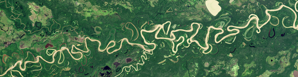
The primary focus of this course is ICT application in water management and water security. It will cover a number of technologies including distance learning, remote sensing, geospatial technologies, and decision-support systems, among others. In particular, the role of satellite-based earth monitoring and remote sensing for environmental studies and management will be discussed highlighting their potential and limitations. In addition, a series of recently completed and ongoing research projects in the field of geospatial-based decision-making will be presented first-hand by practitioner and discussed. The course will contribute to disseminating recent research results and raising awareness about potential ICT benefits.
Target Group
The primary target groups are decision- and policy-makers in national and international environmental organizations. Previous exposure to advanced geospatial technologies is not required, but general computer literacy is essential due to practical computer exercises.
Workshop Directors:
Viktor Lagutov, Central European University (CEU), Budapest, Hungary
Mahesh Pradhan, United Nations Environmental Programme, Nairobi, Kenya
Workshop Faculty:
Lorant Czaran, United Nations Office for Outer Space Affairs, Vienna / EyeOnEarth Disaster Management Special Initiative
Dean Djokic, Esri, California, USA
Zsuzsanna Gabor, Academic Cooperation and Research Support Office, CEU, Budapest, Hungary
Andreas Hörfurter, Amina Foundation, Germany
Zoltan Illes, Minister of Environmental Affairs, Hungary
Annukka Lipponen, Water Convention, United Nations Economic Commission for Europe
Irina Makarenko, Commission on the Protection of the Black Sea Against Pollution
Arnold Nagy, Environmental Systems Laboratory, Central European University, Budapest, Hungary
Larissa Owen, Abu Dhabi Global Environmental Data Initiative (AGEDI)
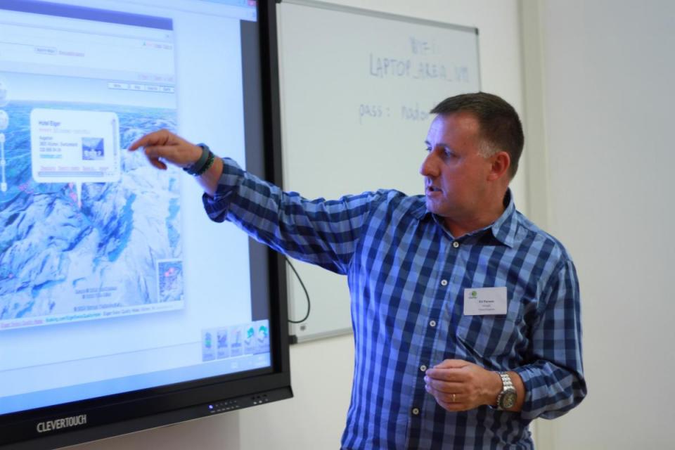
Ed Parsons, Google, London, UK
Alexander Prishchepov, IAMO (Leibniz-Institut für Agrarentwicklung in Transformationsökonomien), Halle, Germany
Nicolas Ray, UNIGE/ UNEP GRID-Geneva
Additional Information
This course is being run as a preparatory activity for the Eye on Earth Summit and is a part of the ISEPEI project, a joint project of UNEP's GUPES and CEU, with the support of AGEDI. This course is being run with the collaboration of Esri and the support of the United Nations Office for Outer Space Affairs (UNOOSA).
See photos from the event here. In addition, Google's geospatial technologist Ed Parsons led a lecture at CEU in February 2014 entitled "Mapping the World from Pizza to Portal". Photos from Parsons' lecture can be seen here.